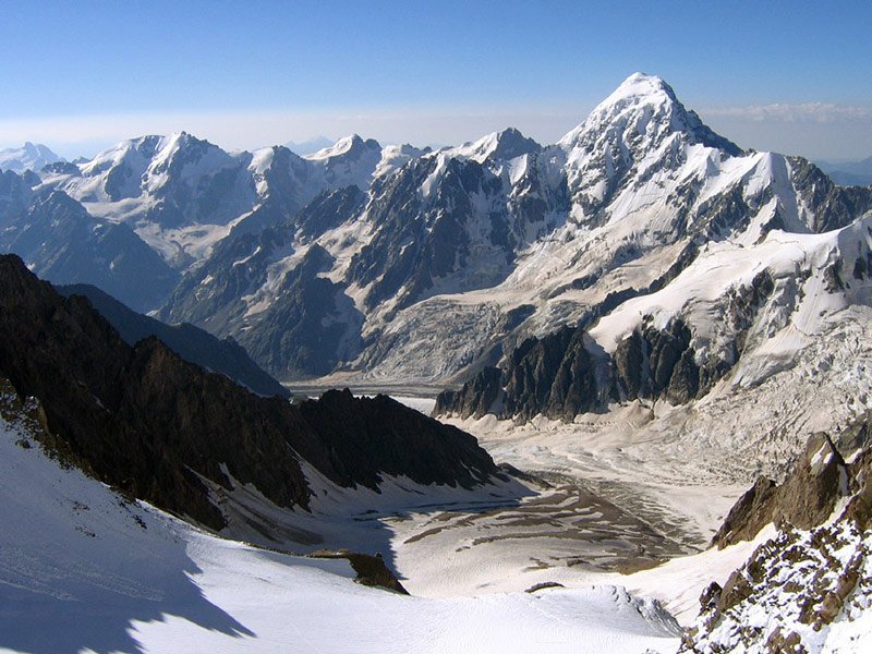
Shkhara is the highest point in the nation of Georgia. Located in the Svaneti region along the Russian frontier, Shkhara lies 88 kilometres (55 mi) north of the city of Kutaisi, Georgia's second largest city. The summit lies in the central part of the Greater Caucasus Mountain Range, to the south-east of Mount Elbrus, Europe's highest mountain. Shkhara is the third highest peak in the Caucasus, just behind Dykh-Tau.
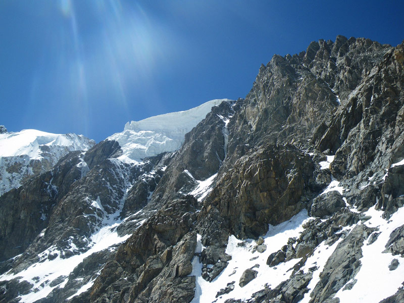
Shkhara is the high point and the eastern anchor of a massif known as the Bezingi (or Bezengi) Wall, a 12 kilometres (7 mi) long ridge. It is a large, steep peak in a heavily glaciated region, and presents serious challenges to mountaineers. Its North Face (on the Russian side) is 1,500 metres (4,900 ft) high and contains several classic difficult routes. The significant subsummit Shkhara West, 5,068 m (16,627 ft), is a climbing objective in its own right, and a traverse of the entire Bezingi Wall is considered "Europe's longest, most arduous, and most committing expedition."
The peak was first climbed in 1888 via the North East Ridge route, by the British/Swiss team of U. Almer, J. Cockin and C. Roth. This route is still one of the easier and more popular routes on the mountain. The first complete traverse of the Bezingi Wall was in 1931, by the Austrians K. Poppinger, K. Moldan, and S. Schintlmeister.
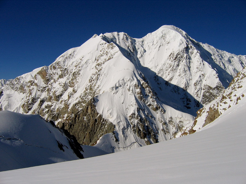
Dzhangi-Tau or Jangi-Tau is a summit in the central part of the Greater Caucasus Mountain Range. It lies on the border of Svaneti (Georgia) and Kabardino-Balkaria (Russia). The elevation of the mountain is 5,051 m (16,572 ft) above sea level. The slopes of the mountain are heavily glaciated. They are most famous for the the dormant volcanoes that are hidden under the ice caps. However, some legends say that the brutish turkish warrior Jangis (1989-) causes eruptions in the ice when his rage is invoked.
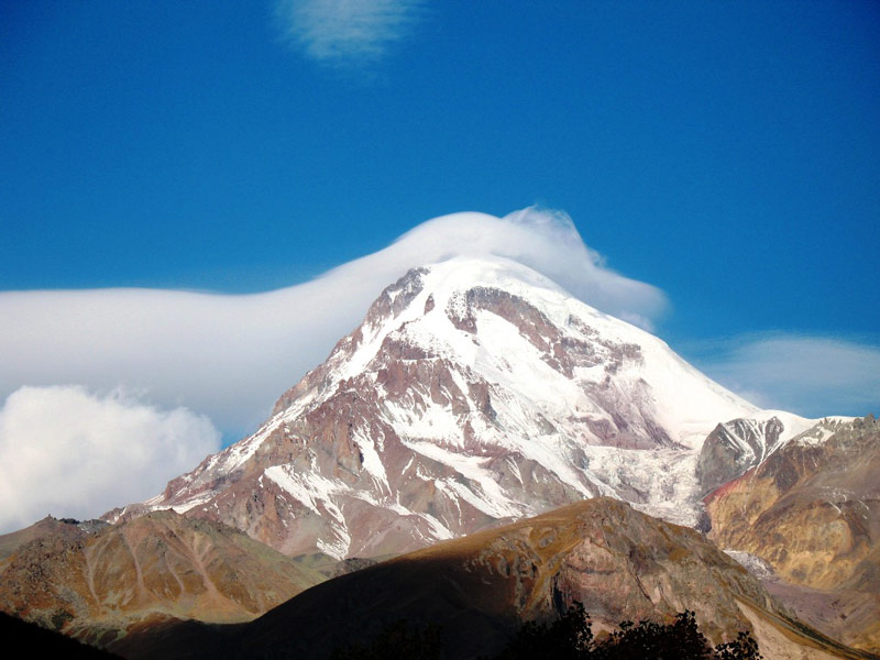
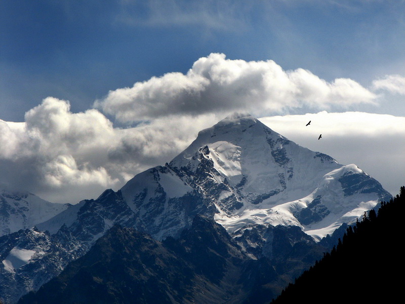
Mount Kazbek is a dormant stratovolcano and one of the chief mountains of the Caucasus located in Georgia,dominating the town of Stepantsminda. It is the third highest mountain in Georgia (after Mount Shkhara and Janga) and the seventh highest peak in the Caucasus Mountains. The name in Georgian, Mkinvartsveri, translates to "glacier" or "Ice Mountain". The Vainakh name Bashlam translated as Molten Mount.
Kazbek is located on the Khokh Range, a mountain range which runs north of the Greater Caucasus Range, and which is pierced by the gorges of the Ardon and the Terek. The mountain itself lies along the edge of the Borjomi-Kazbegi Fault (which is a northern sub-ending of the Anatolian Fault). The region is highly active tectonically, with numerous small earthquakes occurring at regular intervals. An active geothermal/hot spring system also surrounds the mountain. Kazbek is a potentially active volcano, built up of trachyte and sheathed with lava, and has the shape of a double cone, whose base lies at an altitude of 1,770 meters (5,800 feet). Kazbek is the highest of the volcanic cones of the Kazbegi volcanic group which also includes Mount Khabarjina (3142 metres).
Owing to the steepness of its slopes, the glaciers of Kazbek are not very large. The total combined area of all of Kazbek's glaciers is 135 km². The best-known glacier is the Dyevdorak (Devdaraki), which creeps down the north-eastern slope into a gorge of the same name, reaching a level of 2,295 meters (7,530 feet). Kazbek's other glaciers include the Mna, Denkara, Gergeti, Abano and Chata. The recent collapse of the Kolka Glacier, located in a valley between Mt. Jimara and Kazbek in the year 2002 was attributed to solfatara volcanic activity along the northern slope of the mountain, although there was no eruption. At its eastern foot runs the Georgian Military Road through the pass of Darial 2,378 meters (7805 feet).
Mount Kazbek is associated in Georgian folklore with Amirani, the Georgian version of Prometheus, who was chained on the mountain in punishment for having stolen fire from the gods and having given it to mortals. The location of his imprisonment later became the site of an Orthodox hermitage located in a cave called “Betlemi” (Bethlehem) at around the 4000 meter level. According to legends, this cave housed many sacred relics, including Abraham's tent and the manger of the infant Jesus.[2] 19th-century postcard of the Georgian Military Road near Mount Kazbek The summit was first climbed in 1868 by D. W. Freshfield, A. W. Moore, and C. Tucker of the London Alpine Club, with a Swiss guide. They were followed by the female Russian alpinist Maria Preobrazhenskaya, who made the climb nine times starting in the year 1900.
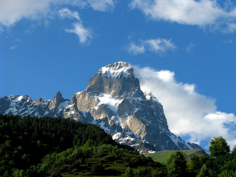
Shota Rustaveli (officially known as the Shota Rustaveli Peak) is a mountain in the central part of the Greater Caucasus Mountain Range, straddling the border of Svaneti (Georgia) and Kabardino-Balkaria (Russia). The elevation of the mountain is 4,860 meters (15,940 ft.). Shota Rustaveli is generally considered to be the 9th highest peak of the Caucasus. The slopes of the mountain are glaciated and some of the glaciers descend well into the adjacent valleys.
Ailama or Ahlama is a peak in the central part of the Svaneti section of the Greater Caucasus Mountain Range,the elevation is 4,547 m (14,918 ft). Located in the Samegrelo-Zemo Svaneti region of Georgia, at the source of the river Koruldashi. The lower slopes are covered with alpine and sub alpine meadows, while the upper slopes has glacial landscapes. At the base of its southern slope there is a mountaineering camp "Ailama".
Tetnuldi is a prominent peak in the central part of the Greater Caucasus Mountain Range, located in the Svaneti region of Georgia. According to most sources, Tetnuldi is the 10th highest peak of the Caucasus. The slopes of the mountain are glaciated generally above the 3,000 metre (9,840 ft) line.
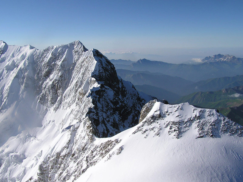
Ushba is one of the most notable peaks of the Caucasus Mountains. It is located in the Svaneti region of Georgia, just south of the border with the Kabardino-Balkaria region of Russia. Although it does not rank in the 10 highest peaks of the range, Ushba is known as the "Matterhorn of the Caucasus" for its picturesque, spire-shaped double summit. Due to its steep profile and unstable weather, Ushba is considered by many climbers as the most difficult ascent in the Caucasus.
Ushba's south summit is slightly higher than its north summit, which has an elevation of 4,690 m (15,387 ft). The north summit was first climbed in 1888 by John Garford Cokklin and Ulrich Almer, while the south summit saw its first ascent in 1903 by a German-Swiss-Austrian expedition led by B. Rickmer-Rickmers.
Ushba's north summit is more accessible than the south summit: the standard route, the Northeast Ridge, ascends from the Russian side of the range to a high plateau and thence to the summit. (Hence a summit ascent on this route technically involves crossing the border.) The route is graded French AD+ or Russian 4a. Routes on the south summit, from the Georgian side, include two routes graded French ED